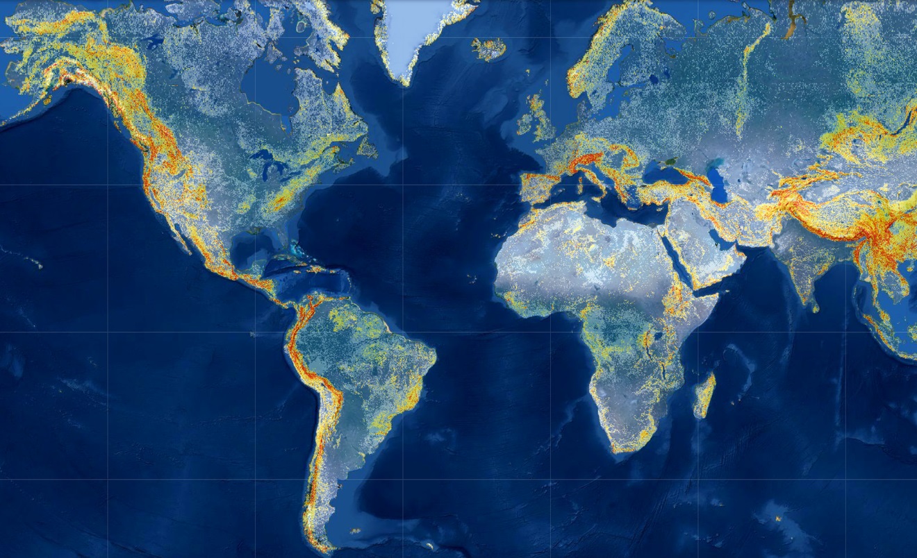
EARTH SCIENCE, Studying Our Home Planet at Jet Propulsion Laboratory, California Institute of technology, NASA, Richard Branson makes historic spaceflight, ABC News, CNET Highlights, and NBC News
EARTH SCIENCE: Studying Our Home Planet at JPL, California Institute of technology
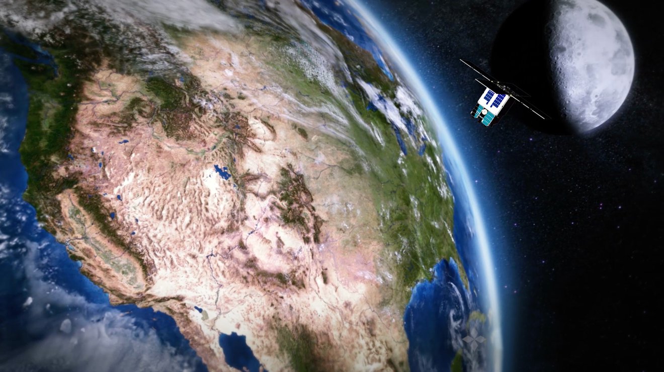
EARTH: Assembly of Satellite to Track World’s Water Shifts From US to France
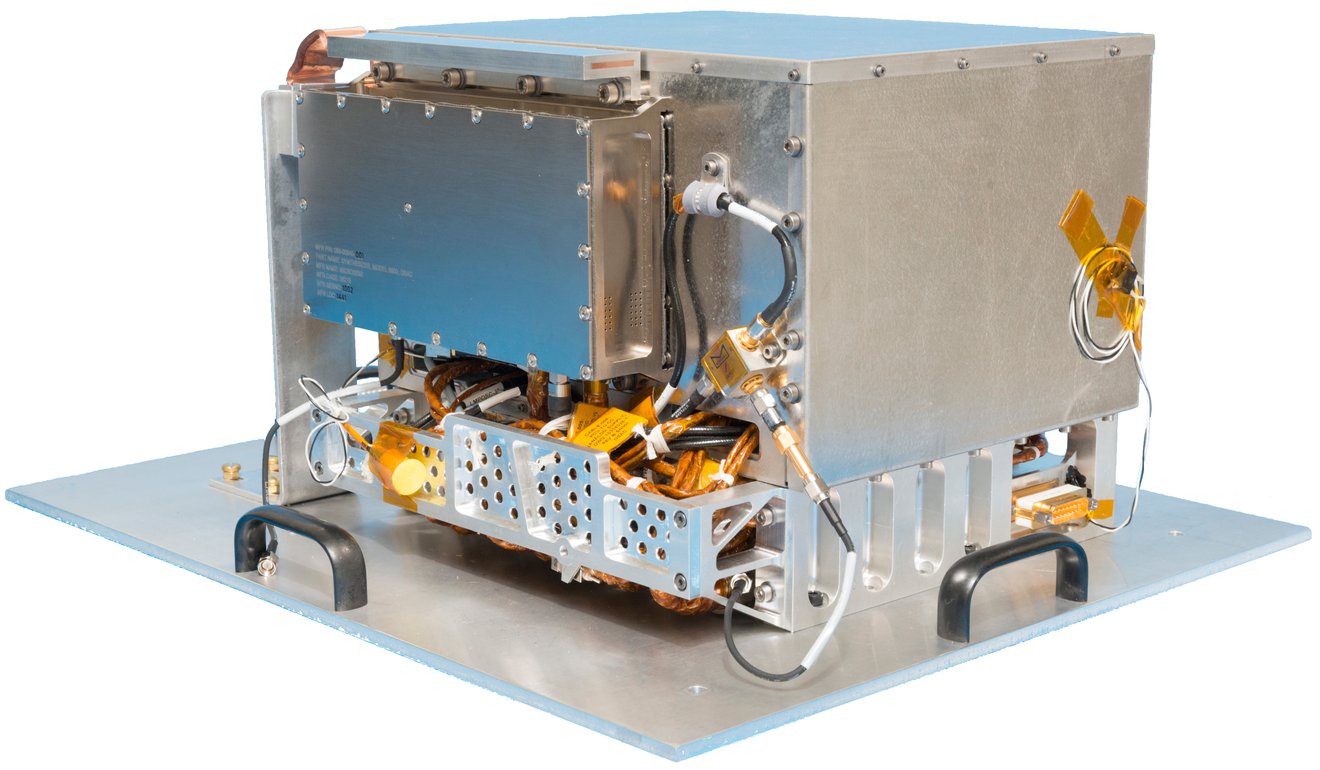
TECHNOLOGY: Deep Space Atomic Clock Moves Toward Increased Spacecraft Autonomy
How NASA’s Deep Space Atomic Clock Could Be the Next Space GPS, Jun 10, 2019 NASA Jet Propulsion Laboratory
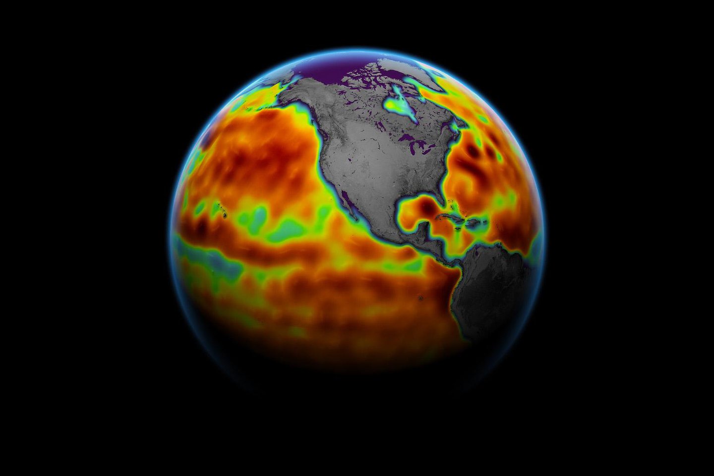
EARTH: Major Ocean-Observing Satellite Starts Providing Science Data
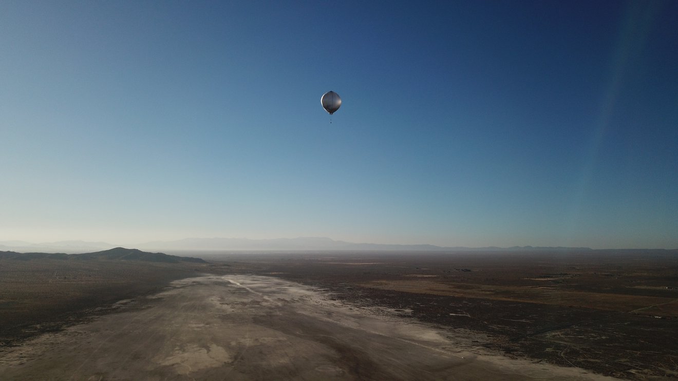
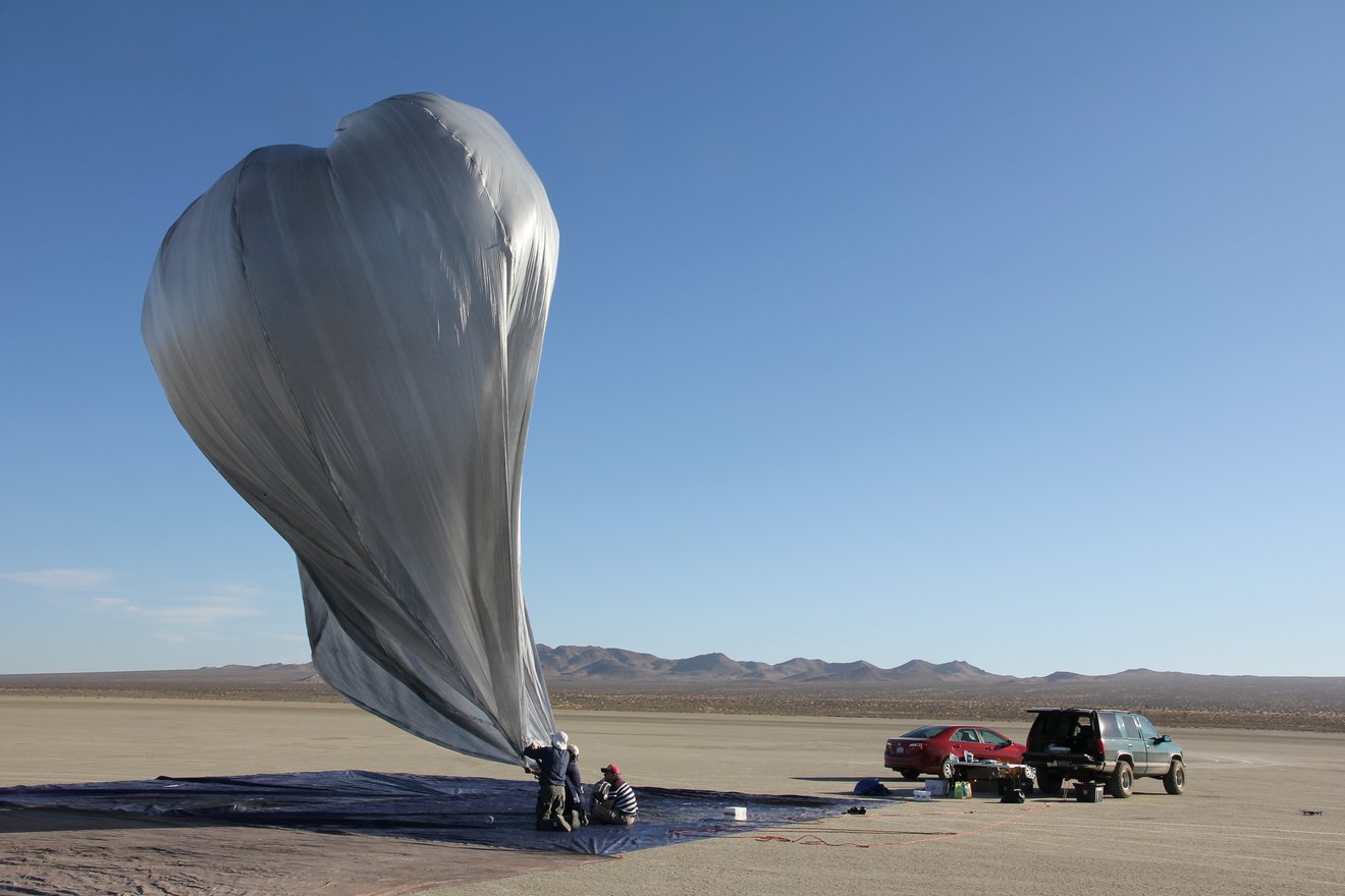
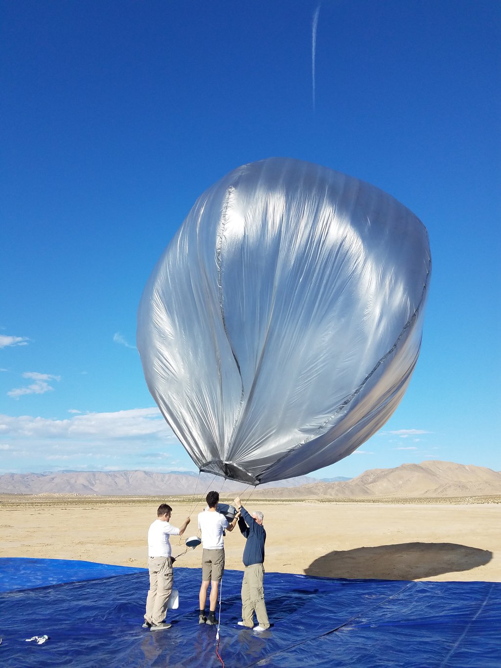
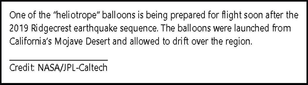
SOLAR SYSTEM: NASA Balloon Detects California Earthquake – Next Stop, Venus?
EARTH: Machine Learning Model Doubles Accuracy of Global Landslide ‘Nowcasts’
CLIMATE CHANGE: Local Lockdowns Brought Fast Global Ozone Reductions, NASA Finds
NASA Finds Local Lockdowns Brought Global Ozone Reductions, Jun 9, 2021 NASA Goddard
CLIMATE CHANGE: NASA Map Gives Most Accurate Space-Based View of LA’s Carbon Dioxide
Carbon Dioxide Over the L.A. Metropolitan Area, Jun 4, 2021 JPLraw
EARTH: Satellites Show How Earth’s Water Cycle Is Ramping Up as Climate Warms
ROBOTICS: Robotic Navigation Tech Will Explore the Deep Ocean
JPL Robotics: Explore a gallery of cutting-edge robot prototypes being developed for future planetary exploration – VIEW GALLERY
EARTH. Caldera Collapse Increases the Size and Duration of Volcanic Eruptions
Caldera Collapse Increases Size of Volcanic Eruptions, May 10, 2021 JPLraw
VIDEO. Water-Monitoring Satellite Moves Closer to Launch
Water-Monitoring Satellite Moves Closer to Launch
Jun 30, 2021 NASA Jet Propulsion Laboratory
Clean Room Sneak Peek: International SWOT Satellite (Live Q&A), May 20, 2021 NASA Jet Propulsion Laboratory
Study Identifies Methane ‘Super-Emitters’ in Largest US Oilfield, NASA Jet Propulsion Laboratory
Richard Branson makes historic spaceflight, Jul 11, 2021 ABC News
Watch Richard Branson’s message from space and full post-spaceflight conference, Jul 12, 2021 CNET Highlights
Richard Branson Holds News Conference After Historic Virgin Galactic Space Flight, 7.11.2021 NBC News
 EARTH SCIENCE
Studying Our Home Planet at JPL

Assembly of Satellite to Track World’s Water Shifts From US to France
![]()
![]()

![]()
Deep Space Atomic Clock Moves Toward Increased Spacecraft Autonomy
How NASA’s Deep Space Atomic Clock Could Be the Next Space GPS
Jun 10, 2019 NASA Jet Propulsion Laboratory
NASA has perfected new navigation technology that would make self-driving spacecraft and GPS beyond the Moon a reality. The Deep Space Atomic Clock is the first atomic clock small and stable enough to fly on a spacecraft beyond Earth’s orbit. As NASA works to put humans on Mars and the Moon, the clock’s precise timekeeping will be key to these missions’ success. For more about the Deep Space Atomic Clock: https://www.nasa.gov/mission_pages/td…

Major Ocean-Observing Satellite Starts Providing Science Data
![]()
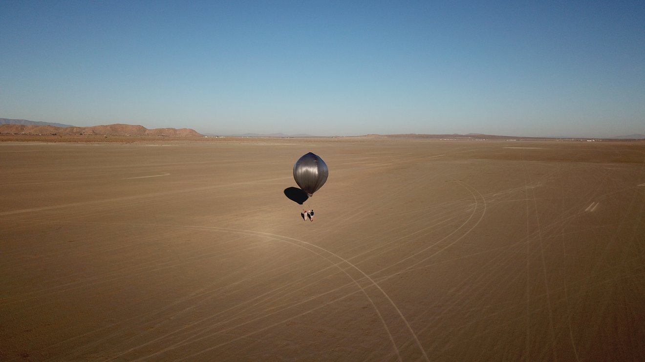
NASA Balloon Detects California Earthquake – Next Stop, Venus?
![]()
![]()
![]()
 EARTH.
Machine Learning Model Doubles Accuracy of Global Landslide ‘Nowcasts’
![]()


Local Lockdowns Brought Fast Global Ozone Reductions, NASA Finds
![]()
NASA Finds Local Lockdowns Brought Global Ozone Reductions
Jun 9, 2021 NASA Goddard
As the coronavirus pandemic slowed global commerce to a crawl in early 2020, emissions of nitrogen oxides (NOx) – which create ozone, a danger to human health and to climate – decreased 15% globally with local reductions as high as 50%, according to a study led by scientists at NASA’s Jet Propulsion Laboratory. As a result of the lower NOx emissions, by June 2020 global ozone levels had dropped to a level that policymakers thought it would take at least 15 years to reach by conventional means, such as regulations. Music credit: Universal Production Music: Waiting For Results – Adam John Salkeld [PRS], Neil Pollard [PRS] Credit: NASA’s Goddard Space Flight Center/Scientific Visualization Studio Katie Jepson (KBRwyle): Lead Producer Carol Rasmussen (NASA/JPL CalTech): Lead Writer Trent L. Schindler (USRA): Lead Visualizer Kazuyuki Miyazaki (JPL): Scientist Kevin W Bowman (JPL): Scientist Kathryn Mersmann (KBRwyle): Associate Producer Katie Jepson (KBRwyle): Editor This video can be freely shared and downloaded at https://svs.gsfc.nasa.gov/13871. While the video in its entirety can be shared without permission, some individual imagery is provided by pond5.com and is obtained through permission and may not be excised or remixed in other products. Specific details on stock footage may be found here https://svs.gsfc.nasa.gov/13871. For more information on NASA’s media guidelines, visit https://www.nasa.gov/multimedia/guide… If you liked this video, subscribe to the NASA Goddard YouTube channel: https://www.youtube.com/NASAGoddard Follow NASA’s Goddard Space Flight Center · Instagram http://www.instagram.com/nasagoddard · Twitter http://twitter.com/NASAGoddard · Twitter http://twitter.com/NASAGoddardPix · Facebook: http://www.facebook.com/NASAGoddard · Flickr http://www.flickr.com/photos/gsfc
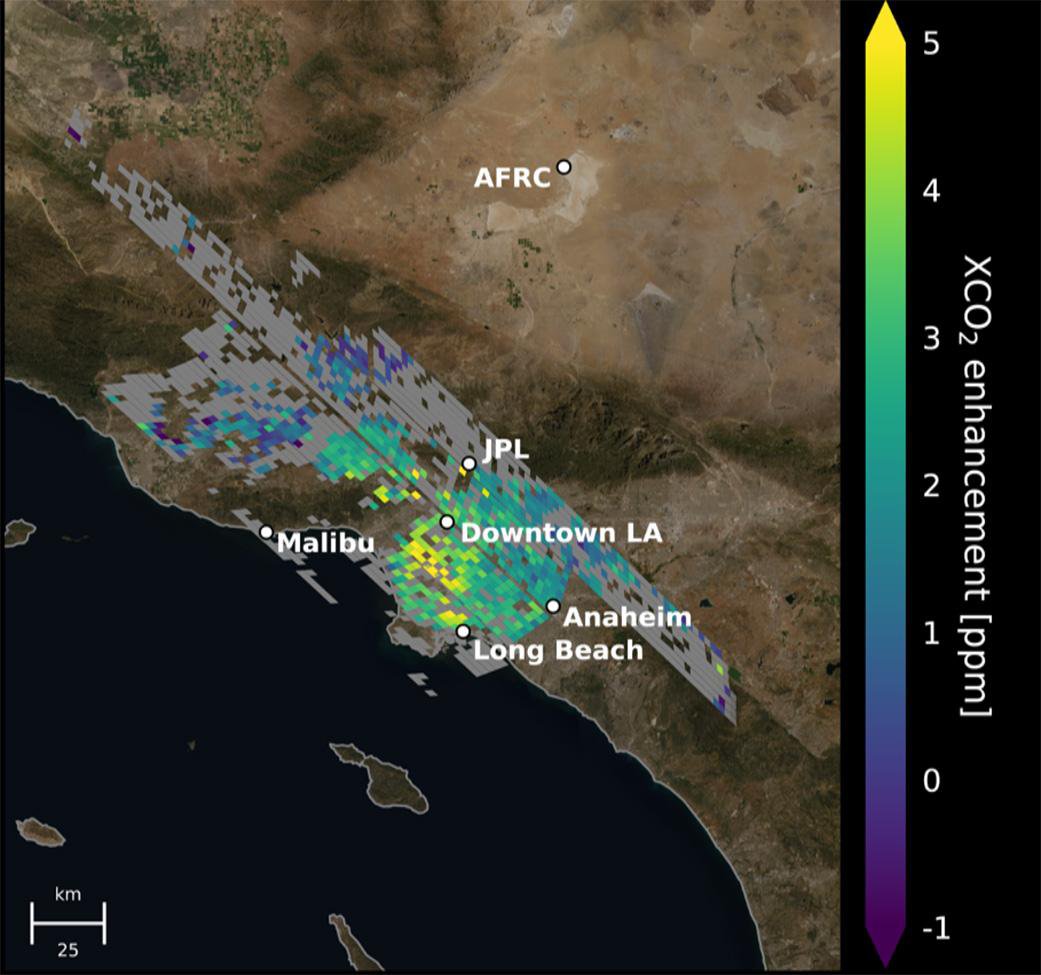
NASA Map Gives Most Accurate Space-Based View of LA’s Carbon Dioxide
![]() https://www.jpl.nasa.gov/news/nasa-map-gives-most-accurate-space-based-view-of-las-carbon-dioxide
https://www.jpl.nasa.gov/news/nasa-map-gives-most-accurate-space-based-view-of-las-carbon-dioxide
Carbon Dioxide Over the L.A. Metropolitan Area
Jun 4, 2021 JPLraw
This animation shows the accumulation of five adjoining swaths of data over the Los Angeles metropolitan area that, when combined, create a map of carbon dioxide (CO2) concentrations that covers about 50 square miles (80 square kilometers). Researchers have used the data, collected by NASA’s Orbiting Carbon Observatory 3 (OCO-3) instrument aboard the space station, to create one of the most accurate maps ever made from space of the human influence on CO2 abundances in the L.A. Basin. Credit: NASA/JPL-Caltech
Satellites Show How Earth’s Water Cycle Is Ramping Up as Climate Warms
![]() https://www.jpl.nasa.gov/news/satellites-show-how-earths-water-cycle-is-ramping-up-as-climate-warms
https://www.jpl.nasa.gov/news/satellites-show-how-earths-water-cycle-is-ramping-up-as-climate-warms
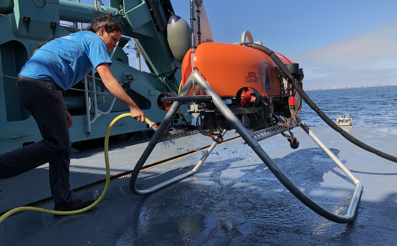
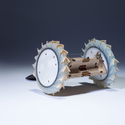
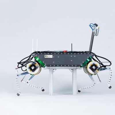
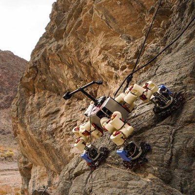
Robotic Navigation Tech Will Explore the Deep Ocean
![]() https://www.jpl.nasa.gov/news/robotic-navigation-tech-will-explore-the-deep-ocean
https://www.jpl.nasa.gov/news/robotic-navigation-tech-will-explore-the-deep-ocean

![]()

![]()

https://www.jpl.nasa.gov/robotics-at-jpl
 Robotics
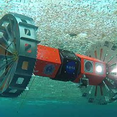
BRUIE
An under-surface rover designed to explore alien oceans.
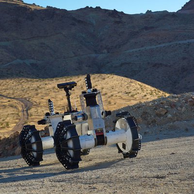
DuAxel
A versatile rover for accessing high-risk terrain.

NeBula-SPOT
Explores complex environments without human guidance.

Rollocopter
An innovative robot that can either roll or fly.
A-PUFFER
A foldable robot that can access tight spaces.

RoMan
A powerful robot designed to work in real-world environments.
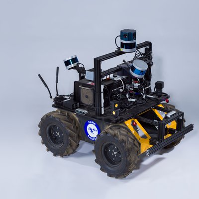
NeBula-Husky
A platform for testing autonomous exploration capabilities in underground environments.
LLAMA
A fast-moving legged robot that can traverse challenging environments.

RoboSimian
This is RoboSimian, an ape-like robot that traverses complex terrain and performs dexterous tasks..
Freeclimber: LEMUR 3
A robot designed to crawl, walk, or climb in extreme terrains.
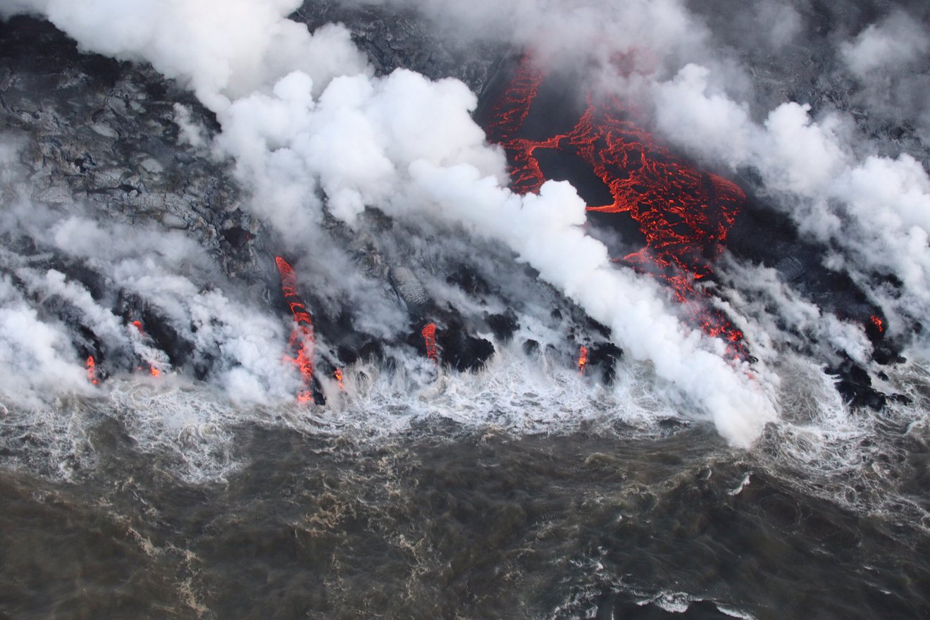
Caldera Collapse Increases the Size and Duration of Volcanic Eruptions
![]() https://www.jpl.nasa.gov/news/caldera-collapse-increases-the-size-and-duration-of-volcanic-eruptions
https://www.jpl.nasa.gov/news/caldera-collapse-increases-the-size-and-duration-of-volcanic-eruptions
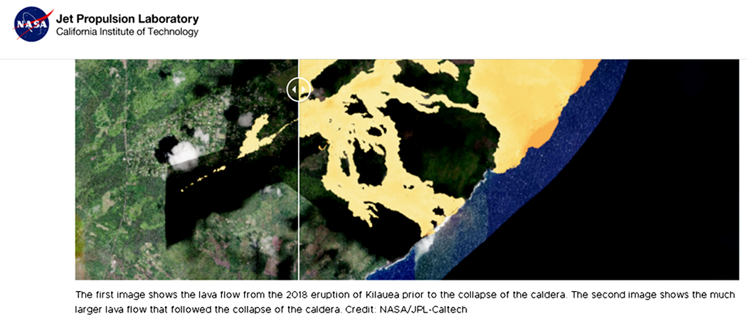
Caldera Collapse Increases Size of Volcanic Eruptions
Unlisted
May 10, 2021 JPLraw
In 2018, Hawaii’s Kilauea volcano experienced its largest eruption in over 200 years. JPL scientists used data from the rare event to better understand what causes large-scale eruptions like this. The culprit? The collapse of a volcano’s caldera – the large, crater-like depression at the volcano’s summit. Kilauea is one of the most active volcanoes in the world. Because of this and its relative ease of accessibility, it is also among the most heavily outfitted with monitoring equipment – instruments that measure and record everything from earthquakes and ground movement to lava volume and advancement. Credit: NASA/JPL-Caltech
EXPLORE MORE

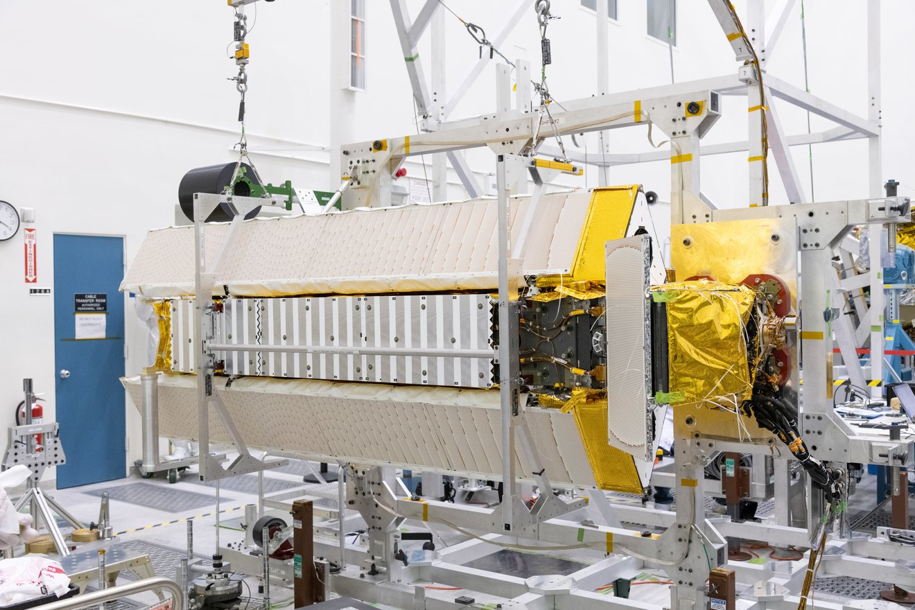
Water-Monitoring Satellite Moves Closer to Launch
Water-Monitoring Satellite Moves Closer to Launch
Jun 30, 2021 NASA Jet Propulsion Laboratory
The Surface Water and Ocean Topography mission (SWOT) will help scientists monitor Earth’s ocean, as well as the amount of freshwater in its lakes and rivers when it launches in late 2022. After engineers put together the spacecraft’s payload of scientific instruments at NASA’s Jet Propulsion Laboratory in Southern California, the satellite now moves to Cannes, France, to complete integration before it will be launched in late 2022. Project manager Parag Vaze explains. SWOT is a collaboration between NASA and the French space agency Centre National d’Etudes Spatial (CNES), with contributions from the Canadian Space Agency (CSA) and United Kingdom Space Agency (UKSA). To learn more about the mission, visit: https://swot.jpl.nasa.gov/ Credit: NASA/JPL-Caltech
Clean Room Sneak Peek: International SWOT Satellite (Live Q&A)
May 20, 2021 NASA Jet Propulsion Laboratory
Check out the new spacecraft we’re building. Targeting a late-2022 launch date, this SUV-size satellite will measure the height of Earth’s water. SWOT will help researchers understand and track the volume and location of water – a finite resource – around the world, making NASA’s first truly global survey of the planet’s surface water. SWOT is being jointly developed by NASA and CNES, with contributions from the Canadian Space Agency (CSA) and United Kingdom Space Agency (UKSA). https://swot.jpl.nasa.gov/ Speakers: Parag Vaze, SWOT project manager, JPL Dr. Karen St. Germain, Earth science division director, NASA Marina Jurica, host Credit: NASA/JPL-Caltech
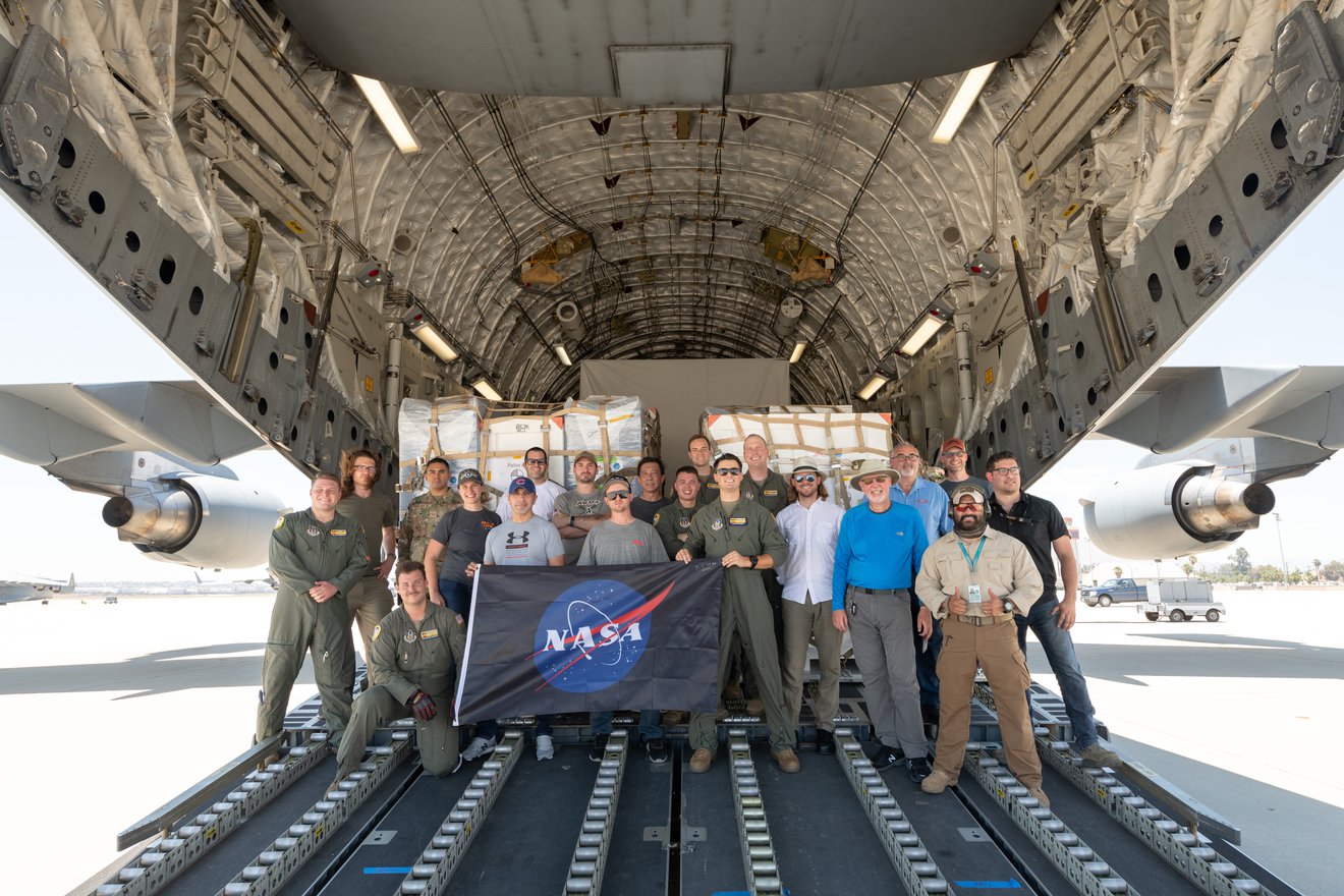
Study Identifies Methane ‘Super-Emitters’ in Largest US Oilfield
Jun 02, 2021
 Gas flaring during oil and gas production is a known source of methane emissions.
Pasadena, CA 91109
Credit: Leslie Von Pless
Fixing just the worst leaks in the Permian Basin oilfield’s infrastructure could cut methane emissions by 55 tons an hour, according to a study by NASA, University of Arizona, and ASU.
About half of the biggest sources of the potent greenhouse gas methane in the Permian Basin oilfield are likely to be malfunctioning oilfield equipment, according to a month-long airborne study by NASA’s Jet Propulsion Laboratory, the University of Arizona, and Arizona State University.
Repeatedly measuring the size and persistence of emission sources using sensor-equipped aircraft, researchers found that repairing only the 123 sources that they found leaking most persistently on their flights would reduce methane emissions by 55 tons (50 metric tons) an hour. That’s equivalent to 5.5% of the U.S. Environmental Protection Agency’s estimates of all methane emissions from oil and gas production in the entire United States.
Get the Latest JPL News
The research team measured methane concentrations around “super-emitter” methane sources – those emitting more than 22 pounds (10 kilograms) of methane per hour – in the oilfield, which is located in Texas and New Mexico. They calculated the emission rates by combining observed methane concentrations with reported wind speeds. Using airborne imaging spectrometers that identify methane and other gases by their effects on reflected sunlight, the campaign located a total of 1,756 super-emitters in a 22,000-square-mile (57,000-square-kilometer) section of the immense oilfield. As they resurveyed the area throughout the month, the team recorded emissions each time a plume was visible, whether once or a dozen times.
“Multiple revisits of these sites are the best way to discriminate between unplanned and planned emissions,” said Daniel Cusworth, a JPL scientist and lead author of an analysis published today in the journal Environmental Science and Technology. Cusworth explained that while some regular operations in an oilfield, such as venting pressure-relief valves, release methane, plumes from these planned operations would probably be visible on only one or two consecutive flights. If an emission plume persists, by far the most likely cause is malfunctioning or broken oil and gas equipment. There’s no other industry in the region that could produce such large plumes, and there are more than 60,000 oil and gas wells as well as compressors, pipelines, and other types of equipment – all of which can potentially leak.
For their analysis, Cusworth and colleagues focused on 1,100 sources seen emitting methane plumes on at least three flights. Just 123 of these were classified as most persistent, with plumes visible on 50 to 100% of revisits. These few sources emitted about 29% of all the methane detected from the entire group. The 258 plumes in the next most persistent class produced an additional 23% of detected emissions; the researchers think these sources are leaks or a mixture of leaks and planned operations. They classified the remaining two-thirds of the sources as least persistent and most likely to be the result of planned operations. This last and largest class produced 48% of emissions.
Once methane sources have been located and verified on the ground by facility operators, there’s a good chance that leaks can be repaired, said Riley Duren of the University of Arizona, who designed and led the flight campaign. “We’ve done cooperative studies with oil and gas operators in California and the Permian where they independently report that 50% of the sources we’re finding are fixable.”
The campaign also recorded surprisingly large variations in the extent of emissions. In one part of the basin, emissions almost doubled over a five-day period and then dropped back almost to the original value over another 10 days. These large, unpredictable variations prove that a single snapshot of methane emissions from any location is inadequate for decision-makers to monitor and regulate emission sources, Duren said. “You need measurements daily or weekly,” he added. “That’s a big argument for using airborne and satellite remote sensing.”
The imaging spectrometers used in the study, NASA’s Next-Generation Airborne Visible/Infrared Imaging Spectrometer and ASU’s Global Airborne Observatory, are able to pinpoint methane sources to within about 15 to 30 feet (5 to 10 meters) while flying at the altitude of a commercial airliner. When methane emission plumes were detected, researchers used a high-resolution camera to relate the plumes to individual pieces of equipment on the ground.
Data from this study can be viewed and downloaded at the team’s data portal.
Monitor the Planet’s Vital Signs With Eyes on Earth
News Media Contact
Jane J. Lee / Ian J. O’Neill
Jet Propulsion Laboratory, Pasadena, Calif.
818-354-0307 / 818-354-2649
jane.j.lee@jpl.nasa.gov / ian.j.oneill@jpl.nasa.gov
Written by Carol Rasmussen
2021-112
RELATED NEWS
Richard Branson makes historic spaceflight
Jul 11, 2021 ABC News
The billionaire is now the first person to reach the edge of space in his own personal spacecraft.
Watch Richard Branson’s message from space and full post-spaceflight conference
Jul 12, 2021 CNET Highlights
Virgin Galactic founder Richard Branson celebrated with a crowd after his first ride on the VSS Unity to space. 0:00 Riding along with Branson to space 0:58 Branson’s message 1:26 Zero-G 2:58 Returning from space 3:13 Post-flight conference
Live: Richard Branson Holds News Conference After Historic Virgin Galactic Space Flight | NBC News
Streamed live 4 hours ago 7.11.2021 NBC News
Watch live coverage of Sir Richard Branson’s news conference following his successful landing in New Mexico. » Subscribe to NBC News: http://nbcnews.to/SubscribeToNBC » Watch more NBC video: http://bit.ly/MoreNBCNews NBC News Digital is a collection of innovative and powerful news brands that deliver compelling, diverse and engaging news stories. NBC News Digital features NBCNews.com, MSNBC.com, TODAY.com, Nightly News, Meet the Press, Dateline, and the existing apps and digital extensions of these respective properties. We deliver the best in breaking news, live video coverage, original journalism and segments from your favorite NBC News Shows. Connect with NBC News Online! NBC News App: https://apps.nbcnews.com/mobile Breaking News Alerts: https://link.nbcnews.com/join/5cj/bre… Visit NBCNews.Com: http://nbcnews.to/ReadNBC Find NBC News on Facebook: http://nbcnews.to/LikeNBC Follow NBC News on Twitter: http://nbcnews.to/FollowNBC Follow NBC News on Instagram: http://nbcnews.to/InstaNBC Live: Richard Branson Holds News Conference After Historic Virgin Galactic Space Flight | NBC News
Leave a Reply